Patenggang Lake

|

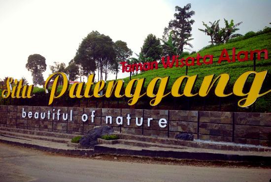
Patenggang Lake (Indonesian: Situ Patenggang) is a lake located in the area of natural tourist attractions in the southern Bandung city, West Java, Indonesia, to be exact it is in Ciwidey village. Located at an altitude of 1600 meters above sea level, this lake has a very exotic landscape.

Originally, this lake is called Situ Patengan by the local society. Since the pronunciation of patengan is too difficult to say in Sundanese, then they call it Situ Patenggang or Patenggang Lake.


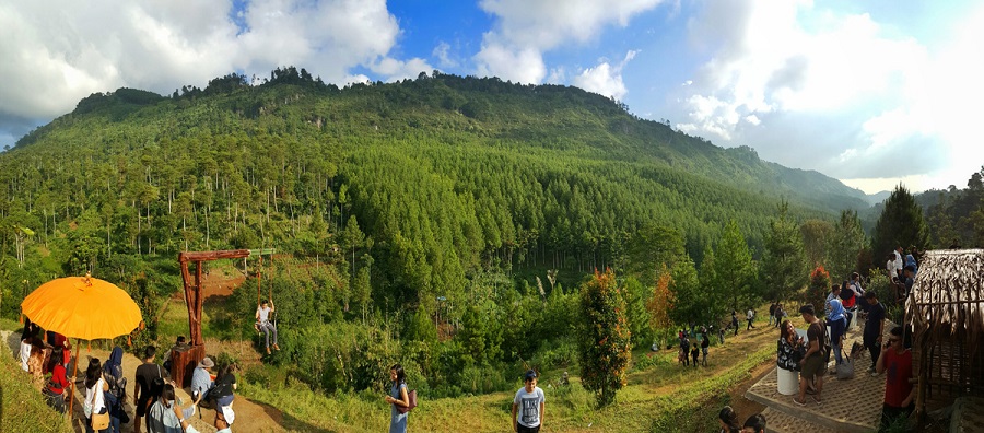
Patenggang Lake Bandung - Ciwidey - West Java


One of the leading resorts is located in less than an hour by road to the south of the city. The eastern side of the lake is a cool forest has an average temperature of 10 degrees C and is often hazy the whole day. A lush tea estate, reaching far out to the west and south, borders the north side. From Cimanggu Hot Spring it is just 30 minutes drive through tea plantations. This is a lovely site for boating, the lake looks a green carpet, and tea plantations surround the lake. Patengan Lake is a very popular spot for Indonesians on a Sunday and public holiday. Its location is in Ciwidey tourism area, 47 kilometers from Bandung to the South, and the site is in the area of Rancabali tea plantation. The tourism site is good for family as it offers hot spring water swimming pool, restaurants, a recreation park for kids, and bungalow as well as other supporting facilities.


Wonderful land Patenggang Lake

To enjoy the tourist boats have facilities that can be rented for around a small island at the end of the lake is named Sasuka Island. This island seems shady with many tall trees that grow in it. While there are locations across the lake is quite interesting that given the name Stone Love is said to believe will provide the continuity of love for the couple who came to visit the location.


Lake Patenggang History or myth about the lake surface caused by a prince’s nephew, King Siliwangi, Ki Santang and a beautiful daughter, distant mountains, goddess Rengganis who fell in love. But they do not travel as smooth as love and beautiful as that envisioned by both as separated by circumstances. So that their tears formed a lake. Later the lake was named Situ Patenggang taken from Sundanese language. In the end they can be together again on a stone there is a stone called love.


Kawah Putih

|

Kawah Putih (White Crater) is a striking crater lake and tourist spot in a volcanic crater about 50 km south of Bandung in West Java in Indonesia.
Wonderful Land - Kawah Putih 

Kawah Putih lake is one of the two craters which make up Mount Patuha, an andesitic stratovolcano. Mt Patuha is one of numerous volcanoes in Java. Kawah Putih crater lake itself represents a relatively stable volcanic system with no records of significant activity since around 1600.

Price of admission 
The Kawah Putih site was opened to visitors in 1987. The lake is 2,430 meters above sea level so the local climate is often quite chilly (temperatures are frequently around 10 degrees Celsius). This makes a brisk change from the humidity of the north Java plain and the capital city of Jakarta. Kawah Putih is a sizeable highly acid lake (pH 0.5-1.3) which changes colour from bluish to whitish green, or brown, depending on the concentration of sulfur and the temperature or the oxidation state. The sand and rocks surrounding the lake have been also leached into whitish colours through interaction with the acidic lake waters (with possible mineral precipitation as well).


WonderfulLand - Kawah Putih Bandung West Java


Wonderful Land - Kawah Putih - West Java


Wonderful Land - Kawah putih

Kuta Beach Bali

|

Kuta is a beach and resort area in the south of the island of Bali, Indonesia. One of Bali's first tourist developments, it's best known for its Indian Ocean surfing and party-centric atmosphere. Kuta's long, consistent waves make it a popular surf spot, particularly for beginners, and plenty of outfitters offer board rentals and surf lessons.

Kuta Beach - Bali Indonesia

Kuta Beach is also minutes away from the Ngurah Rai International Airport in Tuban. The nearby resorts of Tuban, Legian and Seminyak are all within close walking distance. Once a simple, rustic and quiet fishing village, Kuta Beach has witnessed a transformation over the past years due to the rise of various accommodations, dining and shopping options. The rapid growth owes much to visitors, beachcombers and art lovers from nearby Australia. Expatriates also helped pioneer surfing in Kuta, as well. Although a rather frenzied traffic scene has become commonplace here, Kuta Beach continues to attract thousands of visitors every year with its unique charm. During the peak season from July to August and the holiday season for Christmas and New Year, Kuta Beach is regularly fully-booked by travellers looking forward to a pleasant and affordable Bali escape.


Entrance Gate Kuta Beach


Kuta Beach 

Sunset View at Kuta Beach Bali

The Lodge Maribaya

|

The Lodge Maribaya is surrounded by beautiful views of mountains, valley and forest, enjoys a peace which is rare so close to a large city.  This makes it a most romantic location for wedding ceremonies and anniversary celebrations, where large family parties can be accommodated and outside catering arranged for a memorable meal in outstanding surroundings.

Entrance Gate The Lodge Maribaya


The lodge Maribaya is a tourist destination offering camping, team building, trekking activities in beautiful natural surroundings close to pine forest. The lodge situated about 5km east off Maribaya waterfalls, another local tourist attractions close to the city of Bandung, and at an altitude of more than 1000m above sea level.


The Lodge Maribaya

Beyond the pine forests around the Lodge, a vista of wonderful mountain scenery may be seen in every direction. Close to and below The lodge flows the upper Cikapundung river, on its way to Maribaya water falls, while the air in the locality is cool and fresh, with invigorating breezes.

Sky Tree The Lodge Maribaya

The Lodge Maribaya is equipped to support a multitude of activities and will appeal to families, companies and other groups. Adrenaline-pumping activities such as trekking through the forest, camping, flyng fox and fun games are but few examples. The location is also available for private parties such as weddings, birthday celebrations,social and other gatherings.

Camping Tent The Lodge Maribaya


In addition to its beautiful scenery and natural surroundings, The lodge has providing sundanese traditional menu  "Dapur Hawu" and the other "The Pines" serving international light meals, coffee and tea.

The Pines Cafe

MT. Tangkuban Perahu

|

Tangkuban Perahu  is a stratovolcano 30 km north of the city of Bandung, the provincial capital of West Java, Indonesia. It erupted in 1826, 1829, 1842, 1846, 1896, 1910, 1926, 1929, 1952, 1957, 1961, 1965, 1967, 1969, 1983, and 2013. It is a popular tourist attraction where tourists can hike or ride to the edge of the crater to view the hot water springs and boiling mud up close, and buy eggs cooked on the hot surface. Together with Mount Burangrang and Bukit Tunggul, it is a remnant of the ancient Mount Sunda after the plinian eruption caused the Caldera to collapse.

Wonderful land - Tangkuban Perahu

The name translates roughly to "upturning of (a) boat" or "upturned boat" in Sundanese, referring to the local legend of its creation. The story tells of "Dayang Sumbi", a beauty who lived in West Java. She cast away her son "Sangkuriang" for disobedience, and in her sadness was granted the power of eternal youth by the gods. After many years in exile, Sangkuriang decided to return to his home, long after the two had forgotten and failed to recognize each other. Sangkuriang fell in love with Dayang Sumbi and planned to marry her, only for Dayang Sumbi to recognize his birthmark just as he was about to go hunting. In order to prevent the marriage from taking place, Dayang Sumbi asked Sangkuriang to build a dam on the river Citarum and to build a large boat to cross the river, both before the sunrise. Sangkuriang meditated and summoned mythical ogre-like creatures -buto ijo or green giant(s)- to do his bidding. Dayang Sumbi saw that the tasks were almost completed and called on her workers to spread red silk cloths east of the city, to give the impression of impending sunrise. Sangkuriang was fooled, and upon believing that he had failed, kicked the dam and the unfinished boat, resulting in severe flooding and the creation of Tangkuban Perahu from the hull of the boat.


Queen Creater (Kawah Ratu)


Domas Creater ( Kawah Domas )

Komodo island

|

KOMODO NATIONAL PARK IS LOCATED IN THE CENTER OF THE INDONESIAN ARCHIPELAGO, BETWEEN THE ISLANDS OF SUMBAWA AND FLORES. ESTABLISHED IN , INITIALLY THE MAIN PURPOSE OF THE PARK WAS TO CONSERVE THE UNIQUE KOMODO DRAGON (VARANUS KOMODOENSIS) AND ITS HABITAT. HOWEVER, OVER THE YEARS, THE GOALS FOR THE PARK HAVE EXPANDED TO PROTECTING ITS ENTIRE BIODIVERSITY, BOTH TERRESTRIAL AND MARINE. IN 1986, THE PARK WAS DECLARED A WORLD HERITAGE SITE AND A MAN AND BIOSPHERE RESERVE BY UNESCO, BOTH INDICATIONS OF THE PARK'S BIOLOGICAL IMPORTANCE.

KOMODO ISLAND - INDONESIA


KOMODO NATIONAL PARK INCLUDES THREE MAJOR ISLANDS: KOMODO, RINCA AND PADAR, AS WELL AS NUMEROUS SMALLER ISLANDS CREATING A TOTAL SURFACE AREA (MARINE AND LAND) OF 1817KM (PROPOSED EXTENSIONS WOULD BRING THE TOTAL SURFACE AREA UP TO 2,321KM2). AS WELL AS BEING HOME TO THE KOMODO DRAGON, THE PARK PROVIDES REFUGE FOR MANY OTHER NOTABLE TERRESTRIAL SPECIES SUCH AS THE ORANGE-FOOTED SCRUB FOWL, AN ENDEMIC RAT, AND THE TIMOR DEER. MOREOVER, THE PARK INCLUDES ONE OF THE RICHEST MARINE ENVIRONMENTS INCLUDING CORAL REEFS, MANGROVES, SEAGRASS BEDS, SEAMOUNTS, AND SEMI-ENCLOSED BAYS. THESE HABITATS HARBOR MORE THAN 1,000 SPECIES OF FISH, SOME 260 SPECIES OF REEF-BUILDING CORAL, AND 70 SPECIES OF SPONGES. DUGONG, SHARKS, MANTA RAYS, AT LEAST 14 SPECIES OF WHALES, DOLPHINS, AND SEA TURTLES ALSO MAKE KOMODO NATIONAL PARK THEIR HOME.

KOMODO DRAGON


THREATS TO TERRESTRIAL BIODIVERSITY INCLUDE THE INCREASING PRESSURE ON FOREST COVER AND WATER RESOURCES AS THE LOCAL HUMAN POPULATION HAS INCREASED 800% OVER THE PAST 60 YEARS. IN ADDITION, THE TIMOR DEER POPULATION, THE PREFERRED PREY SOURCE FOR THE ENDANGERED KOMODO DRAGON, IS STILL BEING POACHED. DESTRUCTIVE FISHING PRACTICES SUCH AS DYNAMITE-, CYANIDE, AND COMPRESSOR FISHING SEVERELY THREATEN THE PARK'S MARINE RESOURCES BY DESTROYING BOTH THE HABITAT (CORAL REEFS) AND THE RESOURCE ITSELF (FISH AND INVERTEBRATE STOCKS). THE PRESENT SITUATION IN THE PARK IS CHARACTERIZED BY REDUCED BUT CONTINUING DESTRUCTIVE FISHING PRACTICES PRIMARILY BY IMMIGRANT FISHERS, AND HIGH PRESSURE ON DEMERSAL STOCKS LIKE LOBSTERS, SHELLFISH, GROUPERS AND NAPOLEON WRASSE. POLLUTION INPUTS, RANGING FROM RAW SEWAGE TO CHEMICALS, ARE INCREASING AND MAY POSE A MAJOR THREAT IN THE FUTURE.


Raja Ampat

|

The name of Raja Ampat comes from local mythology that tells about a woman who finds seven eggs. Four of the seven eggs hatch and become kings that occupy four of Raja Ampat biggest islands whilst the other three become a ghost, a woman, and a stone.

Raja Ampat Island - Indonesia

History shows that Raja Ampat was once a part of Sultanate of Tidore, an influential kingdom from Maluku. Yet, after the Dutch invaded Maluku, it was shortly claimed by the Netherlands.


The first recorded sighting and landing by Europeans of the Ampat Islands was in the person of the Portuguese navigator Jorge de Menezes and his crew in 1526, on route from Biak, the Bird's Head Peninsula, and Waigeo, to Halmahera (Ternate).

The English explorer William Dampier gave his name to Dampier Strait, which separates Batanta island from Waigeo island. To the east, there is a strait that separates Batanta from Salawati. In 1759 Captain William Wilson sailing in the East Indiaman Pitt navigated these waters and named one strait Pitt strait, after his vessel; this was probably the channel between Batanta and Salawati.


Located off the northwest tip of Bird's Head Peninsula on the island of New Guinea, in Indonesia's West Papua province, Raja Ampat, or the Four Kings, is an archipelago comprising over 1,500 small islands, cays, and shoals surrounding the four main islands of Misool, Salawati, Batanta, and Waigeo, and the smaller island of Kofiau. The Raja Ampat archipelago is the part of Coral Triangle which contains the richest marine biodiversity on earth.

Raja Ampat Regency is a new regency which separated from Sorong Regency in 2004.  The population of the Regency was recently (January 2014) put at 49, 048. It encompasses more than 40,000 km² of land and sea, which also contains Cenderawasih Bay, the largest marine national park in Indonesia. It is a part of the newly named West Papua province of Indonesia which was formerly Irian Jaya. Some of the islands are the most northern pieces of land in the Australian continent.


Raja Ampat is considered the global epicenter of tropical marine bio-diversity and is referred to as The Crown Jewel of the Bird's Head Seascape, which also includes Cenderawasih Bay and Triton Bay.

The oceanic natural resources around Raja Ampat give it significant potential as a tourist area. Many sources place Raja Ampat as one of their top ten most popular places for diving whilst it retains the number one ranking in terms of underwater biodiversity.


According to Conservation International, marine surveys suggest that the marine life diversity in the Raja Ampat area is the highest recorded on Earth.[3] Diversity is considerably greater than any other area sampled in the Coral Triangle composed of Indonesia, Malaysia, Philippines, Papua New Guinea, Solomon Islands, and East Timor. The Coral Triangle is the heart of the world's coral reef biodiversity, making Raja Ampat quite possibly the richest coral reef ecosystems in the world.

The area's massive coral colonies along with relatively high sea surface temperatures, also suggest that its reefs may be relatively resistant to threats like coral bleaching and coral disease, which now jeopardize the survival of other coral ecosystems around the world. The Raja Ampat islands are remote and relatively undisturbed by humans.

The high marine diversity in Raja Ampat is strongly influenced by its position between the Indian and Pacific Oceans, as coral and fish larvae are more easily shared between the two oceans. Raja Ampat's coral diversity, resilience, and role as a source for larval dispersal make it a global priority for marine protection.


1,508 fish species, 537 coral species (a remarkable 96% of all scleractinia recorded from Indonesia are likely to occur in these islands and 75% of all species that exist in the world), and 699 mollusk species, the variety of marine life is staggering. Some areas boast enormous schools of fish and regular sightings of sharks, such as wobbegongs.

Raja Ampat Islands have at least three ponds containt unpoisoned jellyfish, all in Misool area.

Although accessing the islands is not that difficult, it takes some time. It takes six hours flight from Jakarta, the capital city of Indonesia to Sorong. Then, taking a boat to reach the islands is necessary.


Source  www.wonderfulland.top

MT SEMERU

|

Mount Semeru is an active volcano located in East Java, Indonesia. It is the highest mountain on the island of Java. This stratovolcano is also known as Mahameru, meaning 'The Great Mountain.The name derived from the Hindu-Buddhist mythical mo untain of Meru or Sumeru, the abode of gods.

MT. SEMERU - EAST JAVA - INDONESIA

Semeru is named from Sumeru, the central world-mountain in Buddhist cosmology and by extension Hinduism. As stated in legend, it was transplanted from India; the tale is recorded in the 15th-century East Javanese work Tantu Pagelaran. It was originally placed in the western part of the island, but that caused the island to tip, so it was moved eastward. On that journey, parts kept coming off the lower rim, forming the mountains Lawu, Wilis, Kelut, Kawi, Arjuno and Welirang. The damage thus caused to the foot of the mountain caused it to shake, and the top came off and created Penanggungan as well. Indonesian Hindus also hold a belief that the mountain is the abode of Shiva in Java.

Bromo - Tengger - Semeru 


Semeru is one of Indonesia's most active volcanoes. What stands out most about this mountain is the fact that it erupts periodically (and very reliably so). Every 20 minutes (August 2003) the volcano belches out a huge cloud of steam and smoke, sometimes interspersed with ash and stones. The scenery on the way is beautiful (the erupting volcano, the mountain savannah, the lake), and the views from the top are spectacular. You see the vast Sandsea caldera with other volcanoes, among them Bromo and Batok, and the sea. Semeru is a must for all mountaineers, hikers and nature lovers who happen to be in Indonesia. If you are flying from Denpasar to Surabaya, you can see Semeru, and you may see a horizontal chain of clouds stretching away from the peak. These clouds all have the same distance to each other due to the volcano's periodic activity. Many people climb this mountain, tourists and Indonesians alike.
The steep-sided volcano rises abruptly to 3,676 m above coastal plains to the south. It is located at the southern end of a volcanic massif extending north to the 16-km-wide Tengger caldera. The Tengger caldera actually consists of five calderas, the most recent being the 9-km-wide Sandsea caldera, with its cluster of post-caldera cones. The youngest of these cones is Bromo, another of Indonesia's most active volcanoes, and the country's most frequently visited. 


You don't need a guide to find the way up the mountain: once you have left the village behind and are on the track, you can't miss the summit.

Welcome Gate to Bromo Tengger Semeru National Park

Section 1: Ranupane - Lake Kumbolo (Ranu Kumbolo)

There are two tracks leading from Ranupane to Lake Kumbolo. From the eastern track you get a spectacular view of Semeru (see signature photo). 

Eastern approach (via Watu Rejeng): Leaving the village of Ranupane (about 2,000 m), walk up the road to Lumajang for a few hundred meters and turn right just before the road starts going down. There is a signpost and also the rangers are very helpful to put you on the track. Follow the path up through mountain forest to Lake Kumbolo (2,390 m). It will take you about 3 hours to get there. 

Western approach: Info about the western track will be greatly appreciated.

Ranu Kumbolo 2390 M


Section 2: Lake Kumbolo - Kalimati (base camp)

This is an easy and beautiful hike through tussock savannah. It will take you another 3 hours. You can even walk up to Kalimati at night if, for instance, you chose to do Bromo in the morning, set out from Ranupane in the afternoon, and want to reach the base camp on the same day. In a moonlit night, this can be a rewarding experience. 

Oro Oro Ombo 

Section 3: Kalimati (base camp) - summit

From Kalimati a path leads up through mountain forest to the treeline (about 2 hours). The final ascent, above the treeline, is a steep and somewhat strenuous walk over volcanic scree and sand, which will take you another 1 to 2 hours. The top is a rather big, flat area. The present-day crater is a bit further on, below the summit, to the south. From the top, you cannot look inside the crater. For your own safety, stay clear of the crater rim. 


Summit - MAHAMERU

View on MAHAMERU

Source : www.wonderfulland.top

Related Posts Plugin for WordPress, Blogger...